Location, MRT, Schools & Amenities
An established neighbourhood with rail connections, familiar food destinations and everyday essentials close to the town centre.
At Hougang Avenue 10 / Hougang Central, the planned development brings homes, retail, Hougang MRT, a new bus interchange and a town plaza into one mixed-use setting. Beyond the site, the surrounding neighbourhood offers shopping, schools, food and recreation for different stages of family life.
Find the town centre
Explore a destination — select a school or amenity to see its location on the map.
Get to know the neighbourhood
Explore local streets and landmarks around Hougang MRT, then plan a visit to the places that matter to your household. The map shows the neighbourhood rather than a residential entrance or showflat.
Open live neighbourhood map ↗Embedded map: OpenStreetMap. Loading it connects your browser to the map provider. Centred approximately on Hougang MRT. Map contributors and licence.
North East Line today
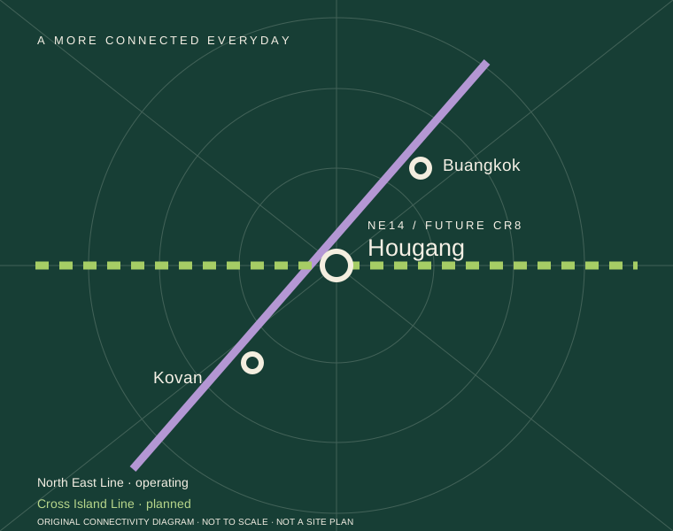
Hougang is NE14 on the operating North East Line. Kovan and Buangkok are its adjacent NEL stations; Serangoon provides a Circle Line interchange, while Dhoby Ghaut connects with the North South and Circle lines. Use the LTA rail network to plan your own destination and transfers.
For your home search, try the journey at your usual commuting hour. Include station access, transfers and the walk to your destination to get a useful picture of the daily routine.
Cross Island Line in the future
LTA’s CRL programme lists Phase 1 for 2030 and Hougang as a North East Line interchange. The future line would broaden Hougang’s rail connections. Its delivery target is subject to change and is separate from the residential completion programme. Our Cross Island Line guide lists every Phase 1 station and the new routes from Hougang.
Bus interchange, stops and useful services
The existing Hougang Central Interchange is stop 64009. A new integrated interchange is planned as part of the development. For journeys today, use LTA’s journey-planning resources and the operator’s route pages to check current stops and services.
| Service | Route highlights | Route information |
|---|---|---|
| 27 | Hougang Central to the Changi Airport loop via Sengkang and Tampines. The operator lists stops at Terminals 3, 1 and 2. | SBS Transit 27. A regular stopping service for airport and intermediate journeys. |
| 51 | Hougang Central to Jurong East, with Upper Serangoon Road stops near the start of the route. | SBS Transit 51. Compare the rail option for the particular destination. |
| 147 | Hougang Central to Clementi, offering another cross-town bus corridor. | SBS Transit 147. Check direction and the exact destination stop. |
| 107 / 107M | LTA’s April 2026 amendment covers changes around Bidadari Park Drive and Bartley Road; 107M links Hougang Central with the Marina Centre area. | LTA amendment notice. 107M has a distinct operating pattern; there is no boarding or alighting at Marina Centre Bus Terminal. |
For local stops, the operator’s 27 route lists Blk 513 (64397), Blk 522 (64389) and Punggol CC (64379) after departing the interchange; its opposite direction includes Hougang Station Exit C (64381). These stop numbers can help you find the right boarding point; check temporary arrangements during road works.
Practical rail connections to major destinations
- Serangoon and NEX: NEL to Serangoon; Circle Line transfer for other destinations on that corridor.
- Orchard Road: NEL to Dhoby Ghaut, then North South Line towards Somerset or Orchard as needed.
- Raffles Place / central business district: one option is NEL to Outram Park, then East West Line towards Raffles Place. Choose the stop closest to the actual workplace.
- Punggol Digital District / SIT: NEL to Punggol Coast, followed by the campus or workplace’s last-leg directions.
- HarbourFront: a direct NEL destination; check the onward building or ferry-terminal route.
Rail relationships: LTA rail network. Allow for waiting, transfers and the walk to your final destination.
Road access and the surrounding network
Hougang Central and Hougang Avenue 10 form the local road setting, with Upper Serangoon Road connecting the wider Kovan and Serangoon corridor. For drivers, the final site plan will show the residential driveway, turning access and drop-off layout.
- KPE: the wider area connects towards Buangkok East Drive and its KPE entrance. LTA’s traffic information identifies the Buangkok East Drive entrance towards ECP. Check current navigation for the approach from your starting point.
- PIE and TPE: LTA identifies the Serangoon Road–Upper Serangoon Road corridor as linking the two expressways. This provides a useful wider-area connection.
- CTE and other city routes: LTA describes that arterial corridor as an alternative to CTE and KPE. The appropriate expressway entry depends on direction and restrictions; check the route at the time you usually travel.
The road network serves surrounding Hougang, Kovan, Serangoon and Sengkang, while the KPE/TPE/PIE system opens further connections. Which route is useful for an employment destination depends on the actual workplace, traffic and current works.
Sources: LTA arterial-road corridors, LTA traffic and road closures and Hougang Central (Minor) closure map.
Distances at a glance
Directory distances are approximate straight-line distances from the Hougang MRT area, rounded to 0.1 km. Actual walking and driving distances depend on crossings, entrances and current works. See our source and measurement notes for details.
Primary schools around Hougang
For families planning ahead, the wider Hougang area offers several primary schools to explore. Consider each school’s programmes, school-day journey and fit for your child alongside the registration requirements.
- CHIJ Our Lady of the Nativity
- Holy Innocents’ Primary School
- Montfort Junior School
- Punggol Primary School
- Xinmin Primary School
- Yio Chu Kang Primary School
Official 1 km and 2 km classifications depend on the applicable residential address and OneMap SchoolQuery for the relevant registration year. These bands are not yet confirmed for this development; the schools above are listed without distance classifications. Refer to MOE’s P1 registration guidance, as proximity does not guarantee admission.
Secondary, junior-college and tertiary options
Families with older children can explore secondary schools in Hougang, junior colleges in the wider area and tertiary campuses connected by rail. The directory brings together addresses and practical travel options; admissions requirements and campus arrangements should be checked with each institution.
| Institution / category | Approx. distance | Getting there and useful details |
|---|---|---|
| Holy Innocents’ High SchoolSecondary school 1191 Upper Serangoon Road | 0.4 km Map ↗ | The Upper Serangoon Road campus is close to the town-centre area; plan the approach using the school’s gate and nearby crossings. Explore the school’s programmes and MOE’s secondary-school posting requirements. |
| Montfort Secondary SchoolSecondary school 50 Hougang Avenue 8 | 0.5 km Map ↗ | The Hougang Avenue 8 campus is west of the town centre. Check the walking route to the school entrance. The school’s website provides current admissions and subject information. |
| Anderson Serangoon Junior CollegeJunior college 1033 Upper Serangoon Road | 0.9 km Map ↗ | The current Upper Serangoon Road campus sits in the wider Hougang–Kovan area. Follow the college’s directions for the entrance. For a future move, check campus arrangements for the year your child will attend. |
| Nanyang Junior CollegeJunior college 128 Serangoon Avenue 3 | 3.7 km Map ↗ | Take the NEL to Serangoon, then the Circle Line to Lorong Chuan and follow the college’s walking directions. Include the transfer and final walk when considering a daily school journey. |
| Nanyang PolytechnicPolytechnic 180 Ang Mo Kio Avenue 8 | 5.0 km Map ↗ | One rail option runs via Serangoon and Bishan to Yio Chu Kang. NYP identifies Exit B for its sheltered walking approach. Compare bus options in LTA’s journey planner and use the destination building for campus directions. |
| Singapore Institute of Technology — Punggol CampusUniversity 1 Punggol Coast Road | 4.9 km Map ↗ | Take the NEL directly to Punggol Coast. SIT identifies Exit 1 for direct campus access. Check the building for your course or visit within the wider campus. |
| Australian International SchoolInternational school 1 Lorong Chuan | 4.4 km Map ↗ | Take the NEL to Serangoon and the Circle Line to Lorong Chuan, followed by the school’s walking route. Check the gate for the relevant age group, including the Early Learning Village at Chuan Lane, alongside admissions and fees. |
| Stamford American — Woodleigh CampusInternational school 1 Woodleigh Lane | 4.6 km Map ↗ | Take the NEL directly to Woodleigh. The school directs visitors through Exit B towards Woodleigh Lane. This is the Woodleigh campus; the Early Learning Village is at a separate location. |
Shopping, groceries, healthcare and community life
From groceries on the way home to a clinic appointment or an exercise session, Hougang’s existing amenities support a varied daily routine. Hougang Mall anchors the immediate town centre, with further shopping, healthcare and community options across the neighbourhood.
| Place / category | Approx. distance | What it offers and how to approach it |
|---|---|---|
| Hougang MallShopping and groceries 90 Hougang Avenue 10 | 0.2 km Map ↗ | A convenient town-centre option for shopping and a meal, with access from the Hougang MRT area. Mall information lists FairPrice and Foodies’ Garden. Browse the current directory for shops, services and opening hours. |
| Heartland Mall KovanShopping and groceries 205 Hougang Street 21 | 1.5 km Map ↗ | One NEL stop south at Kovan, followed by a walk through the station-area shopping cluster. A smaller-scale alternative for shopping and dining. See the mall directory for current outlets. |
| Ci Yuan Hawker CentreFood and dining 51 Hougang Avenue 9 | 1.2 km Map ↗ | West of the MRT town centre, with walking or local-bus options depending on your starting point. Check NEA’s cleaning schedule before a visit; individual stalls have their own hours and rest days. |
| Hougang PolyclinicHealthcare 89 Hougang Avenue 4 | 0.4 km Map ↗ | In the Hougang Avenue 4 civic area, alongside other neighbourhood services. Refer to NHG Polyclinics for appointment arrangements and available services. |
| Sengkang General HospitalHealthcare 110 Sengkang East Way | 2.7 km Map ↗ | Take the NEL to Sengkang, then follow the hospital’s current directions to the appropriate building. Check temporary LRT-loop arrangements before planning a Cheng Lim transfer. |
| Hougang Sport CentreRecreation and community 93 Hougang Avenue 4 | 0.5 km Map ↗ | West of the MRT in the Hougang Avenue 4 civic area, offering a public destination for an exercise session. Check ActiveSG for the selected facility’s availability, bookings and closure notices. |
| Punggol ParkRecreation and community Junction of Hougang Avenues 8 and 10 | 0.9 km Map ↗ | Plan your approach through the surrounding streets and choose the park entrance that suits your route. A pond-centred park on the wider park-connector network, in Hougang and distinct from Punggol Waterway Park. |
| Punggol Community ClubRecreation and community 3 Hougang Avenue 6 | 0.3 km Map ↗ | At Hougang Avenue 6 in the town-centre neighbourhood, despite its Punggol name. Browse onePA for current courses, activities and facilities at the community club. |
More retail choice by rail
NEX at 23 Serangoon Central is another shopping and dining option: Serangoon is two North East Line stops south of Hougang, with an additional station-to-mall approach. Heartland Mall’s Kovan setting provides a different, smaller shopping cluster. These existing destinations add choice while the project’s own retail component is developed.
Books and library services
NLB’s service information describes a Browse-n-Borrow kiosk at Level 1 of Hougang Mall while Cheng San Library undergoes a refresh. Check NLB for the services currently available before your visit.
Food and dining around Hougang
Town-centre meals and mall dining
For an everyday meal, Hougang Mall brings Foodies’ Garden together with grocery shopping in the town centre. Browse its store directory for cafés, restaurants and food-court choices before a visit. This suits a combined grocery-and-meal trip, but individual outlets and their hours can change.
Hawker-centre alternatives
Ci Yuan Hawker Centre at 51 Hougang Avenue 9 provides a wider-neighbourhood hawker destination. Another option is Kovan Market & Food Centre at Block 209 Hougang Street 21, in the Kovan cluster reached by one NEL stop and a local walk. For another neighbourhood food outing, consider Hougang 105 Hainanese Village Centre at Block 105 Hougang Avenue 1, also listed in NEA’s directory.
Plan your route using the published addresses and check NEA’s current cleaning schedule. Individual stall hours and rest days vary.
Cafés and sit-down restaurants
For an arranged meal or café visit, compare the current directories at Hougang Mall, Heartland Mall and NEX. You can combine a meal with shopping or choose a different setting along the North East Line. The project’s own dining mix will take shape with the retail release.
Parks and active living
Punggol Park offers a different type of outdoor space from the more urban Hougang MRT town centre. NParks identifies it at the junction of Hougang Avenues 8 and 10 and places it on the North Eastern Riverine Loop. Check the park entrances to plan your walk or connection to the wider loop.
Hougang Sport Centre and Punggol Community Club provide existing public options for sport and community activities. Consult the current booking, programme and closure information. Together, they offer ways to stay active and take part in neighbourhood life. Details of the condominium’s private facilities will come with the residential release.
Visit with a practical checklist
- Walk your likely route in rain and after dark; check crossings and accessibility.
- Observe bus movements, road noise and servicing at different times.
- Visit the shops, schools and recreation spaces you expect to use regularly.
- Compare the current town centre with the eventual site plan. Construction diversions and future links can change routes.
Next: weigh integrated living against alternatives or review the development timeline.